By Ellen Tordesillas, VERA Files
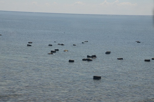
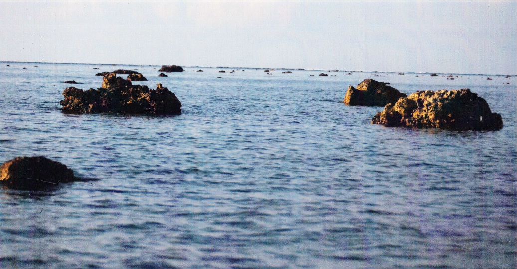
PH Navy photos, Sept. 2, 2013
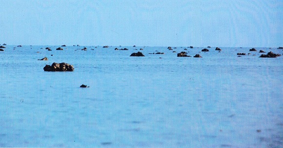
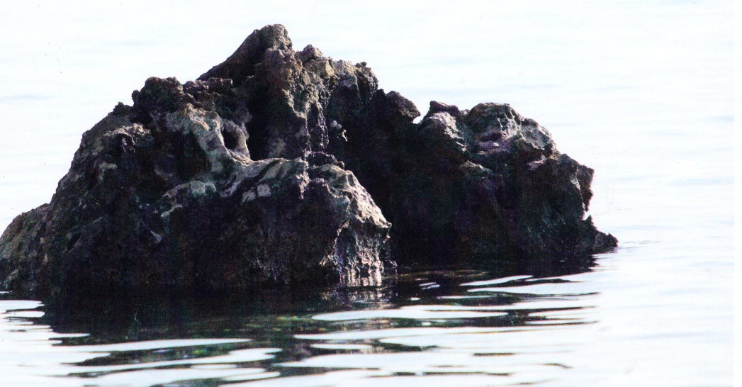
Chinese photos taken second week of Sept. 2013
That is the latest question troubling the strained relationship between the Philippines and China over the disputed Bajo de Masinloc, also known as Scarborough Shoal, off the South China Sea. This time, though, the dispute is playing out through photographs, more than words.
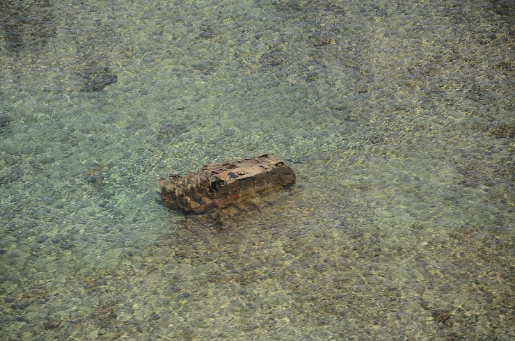
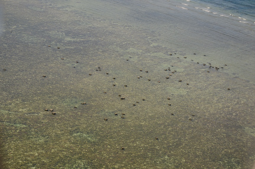
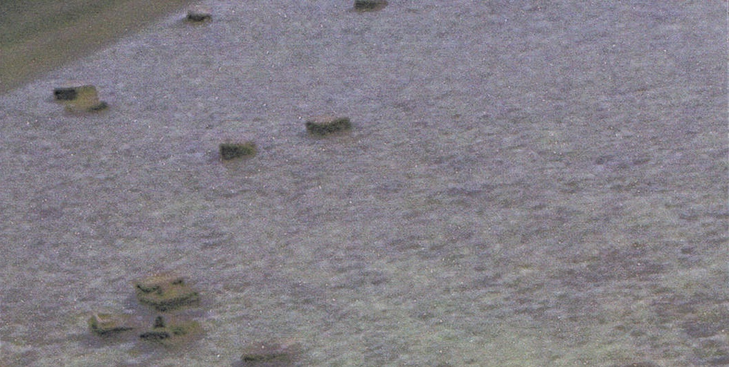
A week after the Armed Forces of the Philippines came out with photographs showing concrete blocks in Bajo de Masinloc, China released photos that showed only rocks and corals.
The photos sent by China to Philippine officials were said to have been taken second week of September to support the statement issued by China’s Foreign Ministry that the Philippine claim was “fabricated.”
Defense Department Spokesman Peter Paul Galvez and Philippine Navy Spokesperson Lieutenant Commodore Gregory Fabic both declined to comment on China’s photos and referred the matter to the Department of Foreign Affairs.
The Philippine Navy, in a monitoring report on Sept 10, found “at least two concrete blocks,” on Bajo de Masinloc, which military officials feared would serve as foundation for future construction.
Navy officials, however, cannot tell from the photos if the concrete blocks were placed there recently or had been there before April 2012.
Navy Chief Vice Adm. Jose Luis Alano earlier said the removal of concrete blocks in the area, currently guarded by at least three Chinese ships, is under discussion.
The concrete blocks in Scarborough shoal, Huangyan Island to the Chinese, are the latest issue in the long-running dispute between the Philippines and China over rock formations 124 nautical miles west of Zambales. These are within the 200-nautical-mile Exclusive Economic Zone (EEZ) of the country but have been under the control of China since April 2012.
DFA Spokesperson Raul Hernandez skirted the issue saying, “We think that to address the issue, the action to be taken would be to focus on the expeditious conclusion of the legally-binding code of conduct on the SCS and also on our preparation of our memorial for the arbitration case with China.”
He did not reply when asked if the concrete blocks on Scarborough Shoal would be included in the Philippine petition before the United Nations Arbitral Court nor did he provide updates on Foreign Affairs Secretary Albert del Rosario’s earlier announcement that the Philippines would file a diplomatic protest.
Defense Secretary Voltaire Gazmin first presented the photos of concrete blocks in Scarborough shoal numbering 75, taken by the Philippine Navy, in a congressional budget hearing last Sept. 3.
Gazmin said the photos, taken on Sept. 2, showed “concrete blocks inside the shoal” which he said “may serve as foundations, platforms, a prelude to construction.” The photos also showed Chinese Coast Guard vessels about 3.2 nautical miles off the shoal’s entrance.
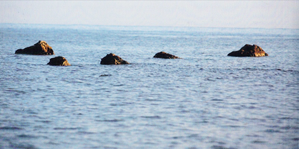
Aside from the concrete blocks, there is a photo showing two vertical posts at north off the shoal’s entrance, which were first seen as early as July this year.
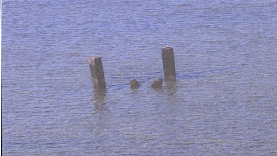
Vertical posts at the entrance of the shoal seen way back July 2013.Sept 2013
Immediately after Gazmin’s congressional disclosure, Chinese Foreign Ministry Spokesperson Hong Lei said, “No one knows the situation on the Huangyan Island better than China. What the Philippines said was completely fabricated.”
Hong reiterated China’s claim over the shoal. “I would like to underline that China’s activities on the Huangyan Island and in its adjacent waters fall entirely within the scope of China’s sovereignty. China urges the Philippines to stop stirring up new troubles and work together with China to uphold peace and stability in the South China Sea and restore bilateral relations,” he said.
Philippines officials fear that the concrete blocks in Scarborough shoal would lead to another “Mischief Reef.”
In February 1995, the Philippines discovered a cluster of huts in Mischief Reef in the Spratly Islands, 130 nautical miles west of Palawan. It is now a military garrison.
The islands in the Spratlys in the South China Sea are being claimed partly by the Philippines, Vietnam, Malaysia and Brunei and wholly by China and Taiwan. The 10-member Association of South East Asian Nations is in talks with China for a Code of Conduct in the South China Sea.
The Philippines has questioned before the U.N. Arbitral Court China’s nine-dashed line map which gives the Asian superpower 90 per cent of the vast South China Sea.
More photos from the Philippine Navy of Scarborough shoal:
More photos from China on Scarborough shoal:
(VERA Files is put out by veteran journalists taking a deeper look at current issues. Vera is Latin for “true.”)